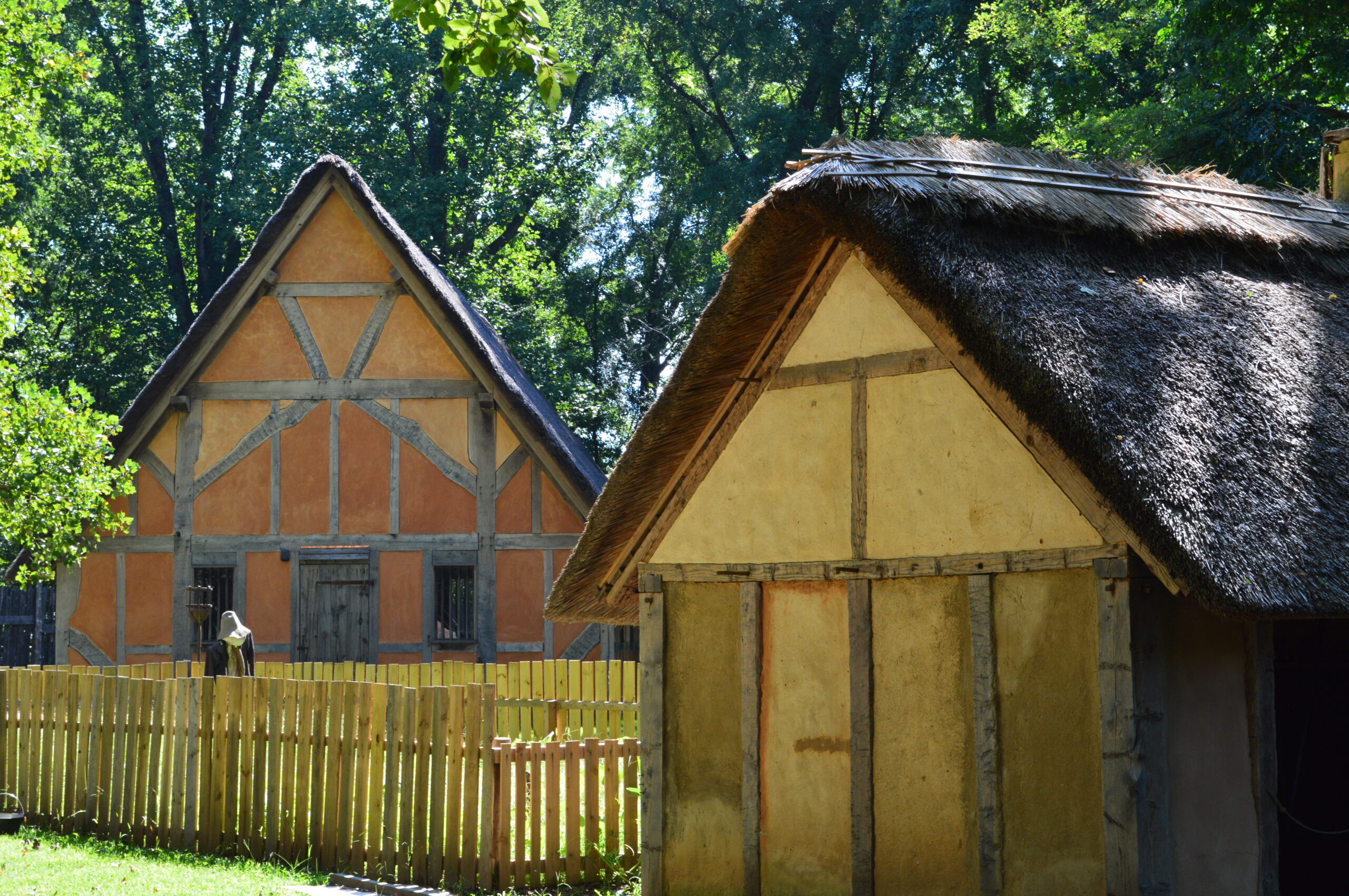
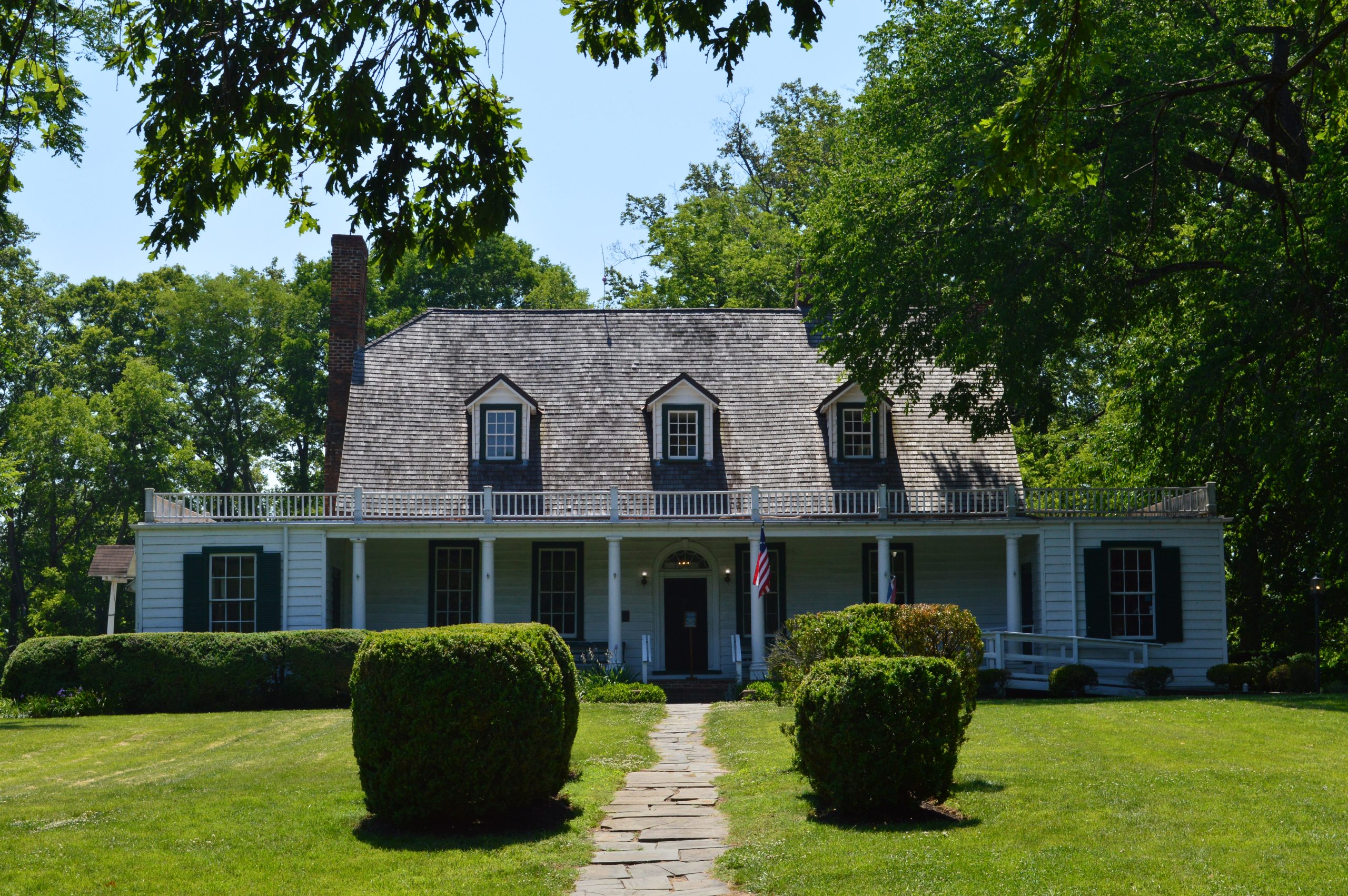
Many people might be familiar with Jamestown Settlement, the first permanent English settlement in the New World. But few might be familiar with the second permanent English settlement, Henricus. Although Henricus only lasted a short time, it still provided many historical firsts to what would become the United States. I also went to see Weston Manor and the Hopewell Riverwalk in nearby Hopewell. Keep reading to learn about other places to visit in the greater area to maximize your time.
Sir Thomas Dale founded Henricus in 1611 alongside 300 settlers for the purpose of finding a less swampy settlement. The settlement lasted a short time due primarily to tobacco, which caused the population to spread out. What remained of Henricus burned down during the second Anglo-Powhatan War in 1622.
Several important things happened during Henricus’ brief time. The minister of the church Alexander Whitaker educated Pocahontas to read & write in English, as well as oversaw her religious education. The first hospital and college in British North America were founded in Henricus, but the college was never completed.
Don’t Let The Picture Fool You, It Was Incredibly Dark Inside
Long after the settlers abandoned Henricus, the site still played an important role in American history. During the Civil War, Union troops under General Benjamin Butler dug a canal on the land to contain Confederate Land Batteries. The channel was completed after the war, turning part of the land into an island. Henricus Historical Park now serves as an open-air history museum, with costumed interpreters and demonstrations.
Right next door to Henricus Historical Park is the Dutch Gap Conservation Area. Dutch Gap consists of one long trail going around a lagoon. I recommend the Conservation Area only if you want to experience the great outdoors, otherwise there’s nothing particularly noteworthy about the place.
Before you go: Henricus Historical Park is only opened from Thursday through Sunday from 10-4. Admission is Free.
Hopewell, Virginia
A 23-minute drive from Henricus Historical Park is Hopewell, a small city on the James River. Hopewell does not have the best reputation, and at first glance there’s nothing spectacular about the city. But look a little deeper and you’ll find some hidden gems.
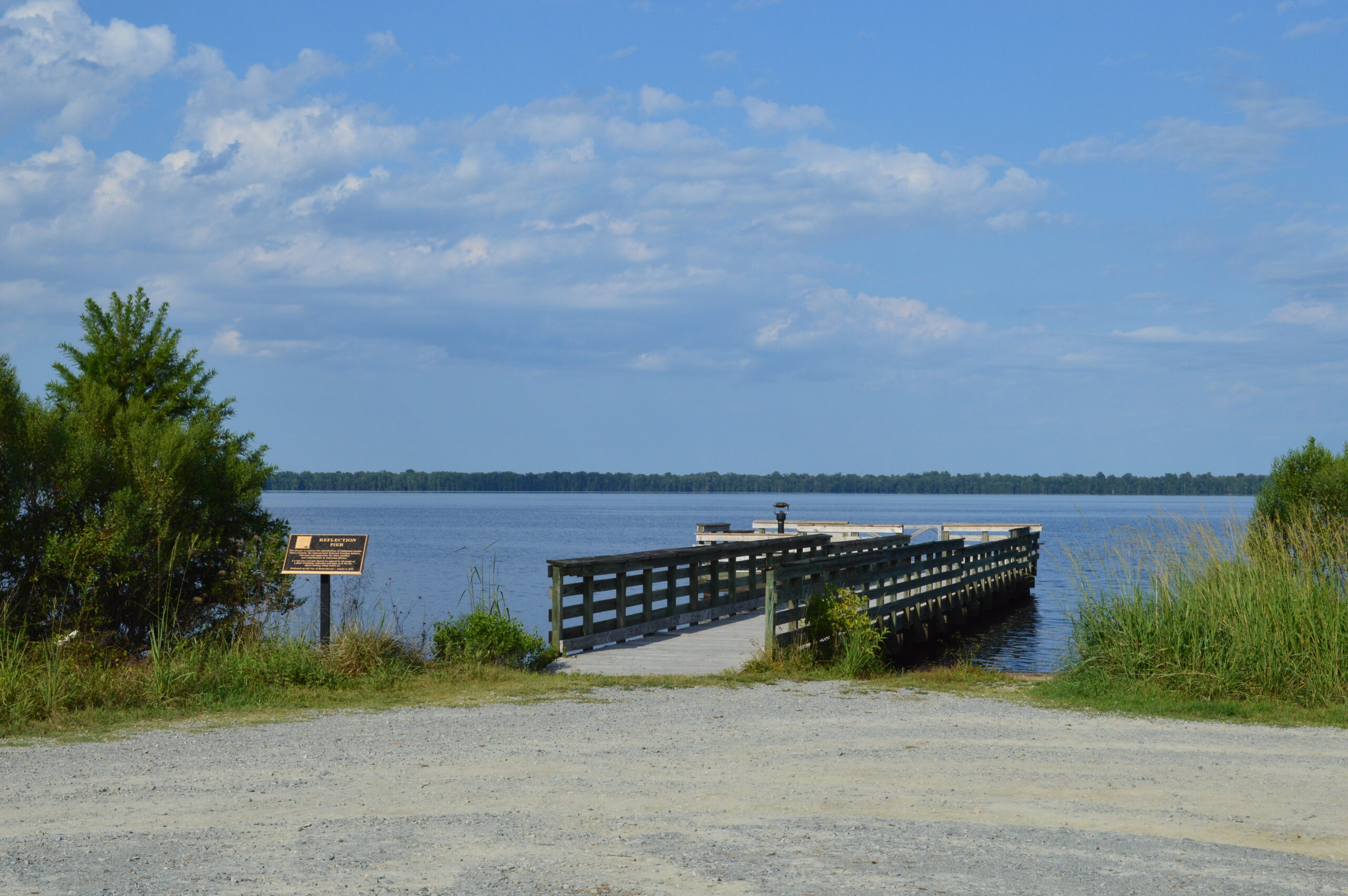
Located in Hopewell City Park is the Riverwalk, which reminded me of the Neabsco Creek Boardwalk but with city views. It’s a lovely place to stroll, but keep in mind there’s barely any shade on the Riverwalk. Also in Hopewell is the Old City Point Waterfront Park, but I was unable to make it there.
Further away from the downtown is Weston Manor, an old plantation home. The house was originally built by William Gilliam, who we know little about because of multiple courthouse fires. During the Civil War, a different family rented the property, and a daughter of the family later published her Civil War diary. The post-Civil War owner originated from Ireland; he intended on entering the priesthood, but on the ship heading to America he saw a beautiful woman. One interesting thing about the house is that it has the second oldest dumbwaiter in America, which still survives. My tour guide gave the offer to touch the replica mattress in order to feel what they were like back in the day. Weston Manor opened every day except Monday; on Sunday the house is only open in the afternoon.
For lunch I ate at the City Point Ice Cream and Burgers. It serves basic hamburgers, but the main attraction are the crazy shakes. Located on the small downtown street.
Conclusion
Overall, I enjoyed my time visiting the under-the-radar Henricus Historical Park and Hopewell Virginia. Visiting both the Historical Park and the attractions of Hopewell make for a fun day out. For further adventures, you could visit nearby Chester/Chesterfield, Petersburg or Richmond, all around a 30-minute drive from Hopewell. Or you could head the opposite direction to Charles City County to visit the historic plantations of Shirley, Berkeley, and Sherwood Forest. And if you wanted to see more colonial history, Colonial Williamsburg and the Jamestown Settlement are both about 75-minutes away.
Here is the companion YouTube video about Henricus Historical Park and the things to do in Hopewell. Please let me know if you enjoyed the video or not.
Once upon a time, the Great Dismal Swamp used to be 1.28 million acres. Over time the swamp shrank due to deforestation and agricultural development, and now the swamp is a third of its original size. Today, Virginia and North Carolina split the remaining portions of the Great Dismal Swamp. The federal government administers the Virginia side as a National Wildlife Refuge (NWR), while the state government administers the North Carolina side as a State Park. Keep reading to see how the two Great Dismal Swamp Parks compare and which one I preferred.
Before the in-depth analysis of the two parks, we should look at their shared histories. The early settlers disparaged the swamps and did not explore the Great Dismal Swamp until the 18th century. The Dismal Swamp Canal, built by enslaved labor, is the oldest artificial waterway in the country. Many self-emancipated African Americas developed settlements deep within the swamps called maroon colonies. These maroons survived in the hot, buggy, densely forested land confident that no one would discover them. Later on, the Great Dismal Swamp became a center of illicit moonshine production during Prohibition.
Great Dismal Swamp NWR, Virginia
This is What You’ll Be Driving On For Most of the Great Dismal Swamp NWR
The Great Dismal Swamp National Wildlife Refuge is massive, taking up much of the remaining Swamp. I only went to one section of the Park (Interior Ditch); besides trails, there’s a small pavilion discussing the Underground Railroad. I only scratched the surface of what you could see in the Park.
Lake Drummond, one of only two natural lakes in Virginia, is the highlight of the Great Dismal Swamp NWR. The waters of Lake Drummond are so black that on windless days it becomes a mirror. But even with choppy waters, the sight of trees growing in the vast expanse of blackness creates an otherworldly experience.
Dismal Swamp State Park, North Carolina
The Dismal Swamp State Park takes up a smaller portion of the remaining Swamp. The North Carolina State Parks main attraction (besides the Canal) is the Swamp Boardwalk, which lets visitors immerse themselves deep into the woods. The rest of the Park consists of trails in more conventional woods, but a replica flat-bottomed boat and moonshine distillery can be found.
Replica Moonshine DistilleryUnknown Metal DrumReplica Flat Bottomed BoatReplica Flat Bottomed BoatA Locomotive Used For Hauling Timber
The Dismal Swamp State Parks closes at 5:30 in the summer and they mean it. When I returned to the entrance at around 5:10, they had closed the gate allowing cars to go through the drawbridge. I noticed that by 5:27 the gates to the parking lot were already locked and the drawbridge pulled up for boats traversing the canal. Luckily, next door to the park is a North Carolina Visitor Center, where you can use the restroom and grab a drink from the vending machine.
Historical Village at the Dismal Swamp
The Historical Village at the Dismal Swamp is located in Chesapeake Virginia. The Historical Village acts a visitor center, with a small exhibit about the history and nature of the Great Dismal Swamp. Although geographically near Lake Drummond, the Historical Village is actually a closer drive to North Carolina’s State Park than to Virginia’s NWR. The Historical Village was brand new when I went there, so if you don’t see it on Google Maps, type this address instead: 5221 Glencoe Street Chesapeake, VA 23322.
Located at the Historical Village is the Cornland School, a one room schoolhouse built in 1902. It served as the school for the African American students of the area. The school had no electricity or running water, and the teacher was expected to make lunch for the students. The schoolhouse fell into disuse after the early 1950s, but was saved and restored to its original appearance.
Which Park Do I Recommend?
I much prefer the Great Dismal Swamp NWR in Virginia due primarily to Lake Drummond’s rare beauty. By contrast, the Dismal Swamp State Park in North Carolina lack any truly unique features would draw me back to the Park. Nevertheless, both parks had their pros and cons, which I will list below.
You could compare the two some more with my companion video about the two Great Dismal Swamp Parks. If you enjoyed it, please like and subscribe, and let me know if you like the video color corrected or if I should try to give my videos a more natural look.
BONUS: Great Dismal Swamp NWR in 2018
I previously went to the Great Dismal Swamp NWR back in 2018 and took some photos. Enjoy these never-before-seen images of the Park. You can see the mirror-like reflections of Lake Drummond more clearly in these images.
On my final full day in Northern Virginia, I actually left the NOVA area to travel to Winchester VA. Although Winchester is not considered part of NOVA, it is relatively nearby as the town was an hour away from my hotel. It was a beautiful drive to Winchester as the landscape changed from flat, urbanized land to rural mountains. This is part three of my NOVA trip, following Alexandria and Leesburg/Waterford and finishing with Chantilly.
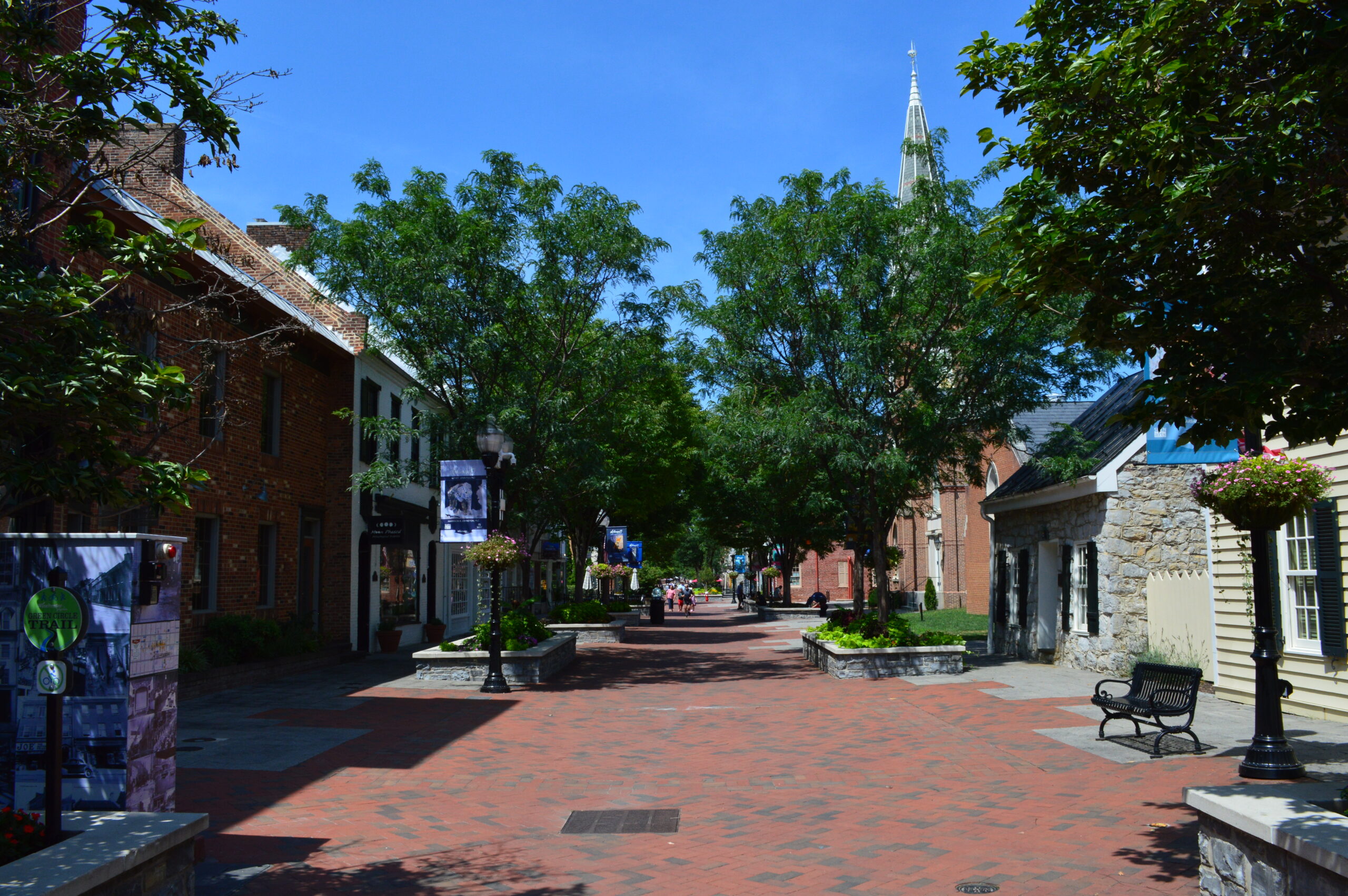
Winchester is the most unique small town I’ve been to because the main thoroughfare has no road going through it. Instead, Old Town Winchester is an entirely pedestrian friendly walking mall that retains the original buildings. It was nice to film a charming small town without having cars and trucks constantly driving by. The rest of Downtown Winchester is more conventional with roads, but it still retains its historic nature.
This Building Served As Headquarters For A Union General
There are plenty of restaurants in Winchester. I went to Benny Meloto’s Pizza which if I’m being honest was not that great of a pizza. However, it was cheap, quick, and filling (since a single slice can fit on two paper plates), so it’s an option for those who want to maximize their time in Winchester.
Places to See in Winchester
Located in the heart of Old Town Winchester is The Shenandoah Valley Civil War Museum, located in what was the third courthouse of Frederick County. The downstairs section talks about the courthouse’s history while the upstairs exhibit talks about the Civil War in the Shenandoah Valley. The design of the second courthouse was so controversial that part of the county broke apart and formed its own county. The Judge presiding over the John Brown trial was came from this court. Winchester changed hands 72 times during the Civil War, the most of any place in America. Graffiti from both Confederate and Union troops remains visible today. The building remained a courthouse until 1984.
Near Old Town Winchester is the George Washington Office Museum, which delves into George Washington’s early years as a surveyor, as well as recounts Winchester’s early years. I did not know that George Washington became a burgess (member of the legislative body) for Frederick County in 1758. After George Washington left, a family lived in the office until 1908 when the city bought the property.
Also near Old Town Winchester is the Handley Regional Library. This grandiose building is still a working library, but they offer tours twice a month. Look up to marvel at the stained-glass dome.
A bit further away is the Stonewall Jackson Headquarters. Jackson originally headquartered at a hotel, but moved to this building when invited by Lewis T. Moore, the second owner of the house. The two men originally met during John Brown’s trial and execution. The tour guide recounted how the women of Winchester hated the Union so much that they grabbed guns and shot at Union troops. The actress Mary Tyler Moore is a descendant of Lewis T. Moore. Also, the visitor entrance seen above was not the original entrance to the house.
A 15-minute walk from Old Town Winchester is the Patsy Cline Historic House and Patsy Cline Memorial Park. While I did not go to the Museum, I highly recommend visiting the Park to appreciate the unique landscaping. I recommend walking to both places, since they are located in an old suburb with minimal parking.
A several minutes’ drive from downtown Winchester is the Museum of the Shenandoah Valley. This museum is a bit odd, since it is a mix of a history and art museum, with displays of quilts and miniature houses. I noticed that the Shenandoah Valley history section had several historic kitchens on display. The Museum is built around the Glen Burnie estate, which remained in the family’s hands throughout the years; the last owner of the house was gay, which probably the first time I’ve ever been to a museum with some LGBT history.
The Glen Burnie Mansion, Which The Museum Was Built Around
About a 24-minute drive away from downtown Winchester is the Long Branch Historic House & Farm. The original builder of the mansion died in the War of 1812, and thus never lived in the house. After the Civil War, the widowed wife of the new owner lost the house, but ended up buying back the house and land in auction. The last private owner of the house owned successful racehorses, and modified the mansion to what it is today.
Conclusion
Those looking for a charming small town with plenty to do should look no further than Winchester, VA. You should spend at least two days exploring Winchester and the surrounding area, because I did not visit the Patsy Cline Historic House, Abram’s Delight, or explore the nearby Sky Meadows State Park. Winchester is definitely worth a stop if one is in the Washington D.C./NOVA area, and is close to both Harpers Ferry or Shenandoah National Park.
Some important information: The Museum of the Shenandoah Valley is closed on Monday, while the Patsy Cline Historic House is closed on Tuesday. When arriving at Long Branch Historic House & Farm, ignore what Waze says and turn right to the north entrance. Once you arrive, the visitor entrance is neither the front or back door, but in a small wing to the left (in orientation of the picture above). Once you arrive, let someone know that you’re a visitor and you would like a tour of the house, as they may be in the back.
Below is my companion YouTube video entitled Best Things to Do in Winchester Virginia. Please subscribe if you liked the video.
I first went to York River State Park in 2016, but I remembered little about it. I decided to go back to the Park this time because I overslept and missed an opportunity to travel further afield. So, what did I think of York River State Park with context now known? Keep reading to find out, and watch the accompanying YouTube video.
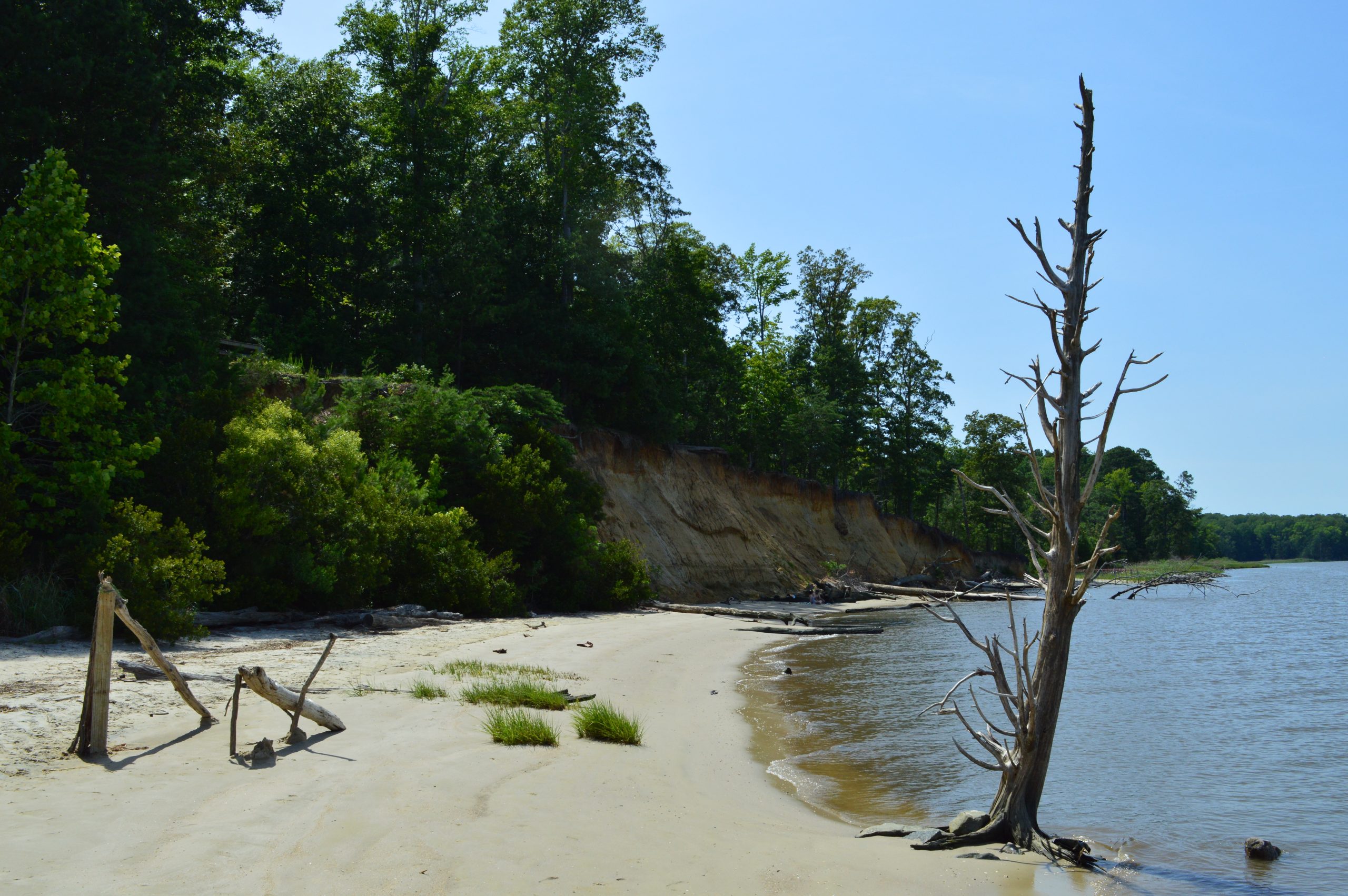
Sign Talking About What You Can Find in Fossil Beach
Fossil Beach is the most beautiful and interesting section of the Park. The fossils themselves are not much, being small shells located in the sandy cliff; you would assume that these are shells that washed up on the beach without knowing the context. But I have always loved wild beaches for their quiet beauty and peaceful nature.
Other Scenic Places
Besides Fossil Beach, York River State Park has other beaches. These beaches (like Seining Beach) are much smaller, but they are still quite nice. York River State Park also contains a pond and marshlands.
Besides the aforementioned beaches, pond, and marsh, York River State Park also has some specific places that are worth noting. An elevated platform stands at the end of the Pamunkey trail, allowing park-goers to see views of the York River. The trails leading up to Fossil Beach and the marsh at Croaker Landing are also lovely.
Stairs Leading to the Observation DeckFootbridge Leading to Fossil BeachStairs Leading to Croaker Landing
The Woods
Much of York River State Park is woodlands. I have become used to the woods of the Tidewater region of Virginia, which can be described as relatively flat with small hills and endless trees surrounding the trail. From this description, this does not make for interesting photographs. Still, I managed to take a few photos of the wooded areas.
My real complaint about York River State Park is how confusing the maps are and how few things are labeled. There are several historic house foundations listed on the map, but they were impossible to find. I foolishly tried to figure out where I was on the Backbone Trail using the branching bike trail, but those trails went all over the place. At some point on the Backbone Trail, there was fork in the road that was (maybe) not listed on the map; I took the right one in a field thinking it would lead me somewhere, but I ended up on private property.
Conclusion
Overall, I feel that York River State Park has a few nice places, but it’s mostly uninspiring woodlands; the Backbone Trail in particular is a long slog to get through. My assessment might be too harsh, but York River State Park is very similar to other parks in the Tidewater region of Virginia, particularly since many of those parks are free. Perhaps I would have appreciated the Park more if I lived in a different ecosystem. Still, there is much to recommend in York River State, and those looking for outdoor recreation can find plenty to do.
Below is my companion YouTube video about York River State Park, which has footage not found on the blog. I also have two videos from my old channel about two other State Parks in Virginia, Machicomoco State Park and High Bridge Trail State Park.
Restaurants
The closest major city to York River State Park is Williamsburg, which has many restaurants. Here are my recommendations from the Colonial Williamsburg post: in order from closest to furthest from the Park is Pierce’s Pitt Bar-B-Que, Maria Bonita Cantina, Anna’s Brick Oven Pizza and Pasta, Honey Butter Kitchen, the restaurants in Colonial Williamsburg, and Bonanza Social Kitchen.
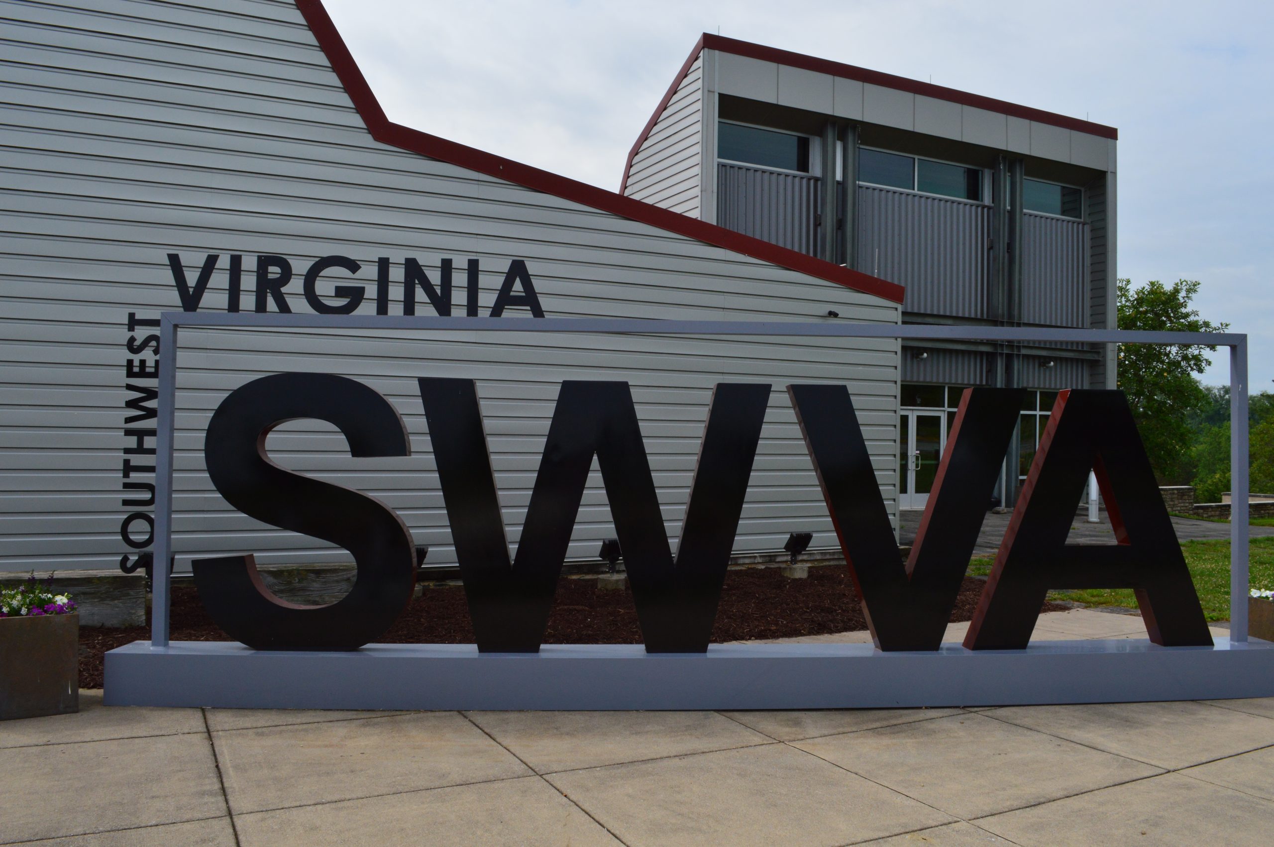
I have lived in Virginia for most of my life, and yet Southwest Virginia had always remained a mystery to me. I had never even heard about Breaks Interstate Park or the Great Channels of Virginia until my adulthood. For someone living in Coastal Virginia, Southwest Virginia (or SWVA) is around a six-hour drive, and for certain destinations even longer. Finally, I received time off from work so I took the opportunity to finally explore what Southwest Virginia had to offer. Keep reading to watch my companion YouTube video.
I chose Abingdon as my headquarters for this Southwest Virginia trip because it is consistently ranked as the prettiest small town in SWVA. While I would personally rank Damascus (discussed below) as more beautiful overall, Abingdon is still a very charming small town with many historic buildings.
This Was Right Next To My Hotel
On our first night there, my Dad and I ate at The Tavern, located in the oldest building in Abingdon. I recommend dining at the restaurant for its atmosphere. We ate outside because the forecast said rain for most of my trip, but I would have been equally happy eating in one of the many historic rooms.
The History Of The Building
A little bit outside the city is the Southwest Virginia Cultural Center and Marketplace, which serves as a welcome center and sells handiwork by local artisans. There were also exhibits about local history but some of them were covered-up by items for sale. The place is worth a quick stop to check everything out, about 15 minutes at most unless you intend on buying something.
The Channels Natural Area Preserve
On Monday I went to The Channels Natural Area Preserve and Breaks Interstate Park (discussed below). These two places were the highlight of my trip. It seems so strange that these two places are not frequently advertised in the best of Virginia.
First, information about The Channels, also known as the Great Channels of Virginia: there are only 10 parking spots and they fill up pretty quickly so arrive early. We arrived at around 7:30 on a Monday to find an already half full parking lot. Although the climb only takes about three hours round-trip, be prepared for an seemingly endless amount of uphill climbing. The first three images provide important information about hiking the Channels, and more practical information can be found here.
This Is Where The Trail BeginsThe Name Of The Trail And Important InformationTurn Left On This Fork On The Trail, The Right Leads To Private Property
I couldn’t find any information about how The Channels were formed, either on site or on the internet. Still, definitely a unique experience exploring the unique rock formations. Below show what you can expect to see hiking the Brumley Mountain Trail and the otherworldly beauty of The Channels.
Breaks Interstate Park
Afterwards, we drove through winding mountain roads to get to Breaks Interstate Park, a massive park that borders Virginia and Kentucky. There was much to do in the park (including a water park), but the highlight is definitely the canyons.
The Breaks is frequently referred to as “the Grand Canyon of the South” and it’s easy to see why with views like this. The Breaks is the largest canyon east of the Mississippi River. Once again, it’s so strange that this natural wonder remains under the radar.
Sign That Explains The Meaning Of The Name
While the park is massive, you can drive through much of it. Most of the scenic spots have short trails, if any, and it’s convenient to park your car up to any place you wish to stop. Do keep in mind that the Tower Overlook and the Tower Tunnel Overlook are two different places.
Cleveland Town Park
Between The Channels and The Breaks, there is a small town called Cleveland, which has a small community park. But this park is unique because it has a suspension bridge over a river. I highly recommend stopping here to take in views of the river.
Bristol
On Tuesday, we went to Bristol Virginia/Tennessee. Bristol is the largest city in the far west of SWVA. The border between Virginia and Tennessee sits right in the middle of Bristol’s main thoroughfare, State Street. One could easily have dinner in one state and catch a show in the other state.
The Virginia Side Of The StreetThe Tennessee Side Of The Street
Bristol prides itself on being the birthplace of country music. On the Virginia side of the city is the Birthplace of Country Music Museum. This museum documents the historic 1927 Bristol sessions, as well as country music’s Appalachian background. Overall, an fascinating look on a topic that I am not necessarily interested in.
Chilhowie Bluegrass JAM-Boree
Parking Was Chaotic, We Parked Next To A Ditch Across The Street
To continue with the Country Music theme, we went to Chilhowie to see the Bluegrass JAM-Boree. The JAM-Boree happens every Tuesday starting at 6:30, located at the Chilhowie Lions Club. I only recommend going if you are fond of Bluegrass or Mountain Music, if not you could probably skip it. However it was intriguing seeing a world different from my own, and I was mesmerized watching the people doing buck dancing.
Big Stone Gap
On Wednesday, we went to Big Stone Gap to see the Southwest Virginia Museum Historic State Park. The town of Big Stone Gap is small but completely surrounded by the mountains giving it grand views. There’s also a river that runs through the town adding to its loveliness.
The Museum itself is actually run by the Virginia State Parks systems, making it the smallest state park in Virginia. The Museum itself is organized a bit awkwardly, with the first floor dedicated to the town’s mining boom years, the second floor dedicated to the mansion’s former owners, and the third floor dedicated to the lives of the early settlers. Still, it’s an interesting overview of the regional history.
Damascus
After lunch, we drove to Damascus, which ended up being my favorite of the small towns. While Abingdon’s buildings were nicer, charming Damascus won out with its rivers and nature. Damascus is actually an important stop on the Virginia Creeper Trail, but unfortunately the trestle was closed while we were there.
Views From The Damascus Old Mill Inn
Wytheville
On our final day, we went to Wytheville to see the Edith Bolling Wilson Birthplace Museum. The town is a typical nice small town, with many nice historic buildings. The most notable thing about Wytheville is the giant pencil suspended from a building.
The Museum itself shows an entertaining look at Edith Bolling Wilson’s girlhood in Wytheville and her time as First Lady of the United States. The upstairs was undergoing renovations when were there, but they provide a video explaining the history behind each room. Renovations should be complete in late 2026.
Conclusion on Southwest Virginia Vacation
I accomplished a decade long (if not longer) dream of exploring Southwest Virginia. Although I did so much, there are still places I didn’t get to visit (like The Devil’s Bathtub and the Natural Bridge State Park), making SWVA a perfect vacation opportunity. I feel SWVA has much to offer for travelers wishing to discover an little known Virginia with unique landscapes and a different history.
Below is the companion YouTube Video for this blog. My video has much more footage of each destination. If you like what you see, please consider subscribing to my channel.
Restaurants In Southwest Virginia
Listed below are the restaurants I ate at on the trip that I recommend. I will go in Alphabetical Order.
Damascus Old Mill Inn: This hotel has a restaurant on the first floor. I recommend eating here for the views of the river and little waterfall. Located in Damascus.
GoodTimes Coal Fired Pizza & Pub: If you’re wondering about coal fired pizza, they use anthracite coal (different from the coal used for powering trains) found only in Pennsylvania, which emits high heat and low emissions as noted by our waitress. All this leads to a great pizza. Located in Big Stone Gap.
Jack’s 128 Pecan: This place must have been a former house, because they were many rooms all decorated differently. They had the best food of all the semi-fancy restaurants we ate on our trip.
Pal’s Sudden Service: For those looking for local color, Pal’s is the local fast-food chain of choice. With its gaudy buildings and commanding pylon signs (the message the day we went said “Respect Is Earned”), Pal’s is definitely an experience. Keep in mind it’s drive-thru only. Located all over SWVA.
Skeeter’s World Famous Hotdogs: Only two doors down from the Edith Bolling Wilson Museum is Skeeter’s, which has been open since 1925. Definitely come here if you love hot dogs, because there was only one non-hot dog thing on the menu; I had the BBQ sandwich. Located in Wytheville.
The Tavern: I’ve already talked about The Tavern above, but here’s some more about the restaurant. It serves a mix of New American and German food. I recommend eating here to absorb the historical ambiance. Located in Abingdon.
Woodbridge is not the first place one thinks of when thinking of major travel destinations in Virginia. Much of the discourse around Woodbridge online revolves around its suburban character; the Prince William County Tourism Website proclaims Woodbridge as having Virginia’s largest outlet mall. But I believe that there are hidden gems in the most seemingly mundane places that are worth a day trip. So here is my suggestions for a fun day out in underrated Woodbridge Virginia. Keep reading for YouTube Videos about other places in Prince William County.
The deciding factor for me to go to Woodbridge was trying Bangladeshi food at Dhansiri Restaurant. Bangladeshi food bares some similarity to Indian food, but more beef oriented. I ordered Beef Bhuna, which was tasty, but even after asking for the mild it still had heat, so I would suggest eating elsewhere if you can’t handle spice.
Rippon Lodge Historic Site
After lunch, I drove to Rippon Lodge Historic Site, which is the second oldest house in Prince William County. Rippon Lodge has seen many changes over the years; it was once a small house built around 1745-1747 by Richard Blackburn, whose son Thomas Blackburn fought in the Revolutionary War under George Washington. The Blackburns and Washingtons grew closer when Thomas’ daughter married George Washington’s nephew.
Rippon Lodge As It Looked Before 1924
Eventually, the Blackburns lost the property and Rippon Lodge changed hands several times until 1924, when Wade H. Ellis and his wife drastically changed the shape of the house to its current appearance. A descendant of the Blackburn family bought the house in 1952 and owned it for half a century. Prince William County acquired the property in 2000 and opened the house for tours in 2007.
I received a self-guided tour with a pamphlet providing information about the house (which is where the above information came from). The employee led me from the admission room to the opposite side of the house. He gave me a basic overview of the house before leaving me on my own. Although I was expecting a guided tour, it was nice to be able to go on my own pace.
One thing Rippon Lodge did that I like is showing what the house looked like throughout the years, rather than focusing on one specific era. I always felt that many historic house museums should focus on a more comprehensive look at the site’s history, especially if no one particularly noteworthy owned the house. The house also revealed the many architectural changes it went through, such as how they moved the chimneys and altered rooms.
The grounds of Rippon Lodge are very beautiful. The pergola covered with roses particularly struck my eye. There’s also a well, some outbuildings, and a family cemetery located on one of the trails.
Neabsco Creek Boardwalk
Neabsco Regional Park Is Also Known As Rippon Landing Park on Google Maps
After Rippon Lodge, I went right across the street to visit Neabsco Regional Park, which is particularly notable for the Neabsco Creek Boardwalk. The Boardwalk is a winding 3,300 feet long (or .625 miles) trail that goes above the marshy Neabsco Creek. The 90-degree heat made the mostly treeless boardwalk a slog, but the views and seeing a beaver building a dam made it all worth it.
At some point, the Boardwalk abruptly ends and turns into a narrow wooden trail that goes deep into the woods. It turns out that the boardwalk is the only connection between the two different sections of Neabsco Regional Park. I only found that out after getting lost in an unmaintained section of the park.
Conclusion
I enjoyed exploring the things to do in Woodbridge. I hope this blog post allows people to view Woodbridge through different eyes. So next time one is looking for a fun day out, consider Woodbridge and Prince William County in Northern Virginia.
The grounds of Rippon Lodge Historic Site are open every day from dawn to dusk, but the house itself is only open from Friday-Monday from 10:00-4:00. Guided tours are supposedly at 11:00 and 2:00, but I arrived at 1:40ish and the employee only gave me the self-guided option, so keep that in mind. More information about the Neabsco Creek Boardwalk found here.
Below is the companion YouTube video, which show in greater detail Rippon Lodge Historic Site and Neabsco Creek Boardwalk.
Other Towns in Prince William County
If one wanted to make a full weekend (or weekday) vacation to Prince William County, I have two videos from my old YouTube channel about Occoquan and Manassas (links in name). Occoquan Historic District consistently ranked as one of Virginia’s most beautiful small towns. Old Town Manassas is the County Seat of Prince William County and played an important role during the Civil War.
If you want to explore more of the NOVA area, read my blog post about Alexandria.
Cookie Consent
We use cookies to improve your experience on our site. By using our site, you consent to cookies.
Contains information related to marketing campaigns of the user. These are shared with Google AdWords / Google Ads when the Google Ads and Google Analytics accounts are linked together.
90 days
__utma
ID used to identify users and sessions
2 years after last activity
__utmt
Used to monitor number of Google Analytics server requests
10 minutes
__utmb
Used to distinguish new sessions and visits. This cookie is set when the GA.js javascript library is loaded and there is no existing __utmb cookie. The cookie is updated every time data is sent to the Google Analytics server.
30 minutes after last activity
__utmc
Used only with old Urchin versions of Google Analytics and not with GA.js. Was used to distinguish between new sessions and visits at the end of a session.
End of session (browser)
__utmz
Contains information about the traffic source or campaign that directed user to the website. The cookie is set when the GA.js javascript is loaded and updated when data is sent to the Google Anaytics server
6 months after last activity
__utmv
Contains custom information set by the web developer via the _setCustomVar method in Google Analytics. This cookie is updated every time new data is sent to the Google Analytics server.
2 years after last activity
__utmx
Used to determine whether a user is included in an A / B or Multivariate test.
18 months
_ga
ID used to identify users
2 years
_gali
Used by Google Analytics to determine which links on a page are being clicked
30 seconds
_ga_
ID used to identify users
2 years
_gid
ID used to identify users for 24 hours after last activity
24 hours
_gat
Used to monitor number of Google Analytics server requests when using Google Tag Manager
1 minute
Marketing cookies are used to follow visitors to websites. The intention is to show ads that are relevant and engaging to the individual user.
OptinMonster is a powerful lead generation tool that helps businesses convert visitors into subscribers and customers.